 Getting There
From Dahlonega, Georgia head West out of town on Hwy 9. Take a right onto Hwy 52, and then 4.6 miles later take a right onto Nimblewill Church Road at the old Grizzle's Country Store. Take a right at the Jake Mountain parking lot sign, and take a left/straight into the first parking lot. The trail starts by the corner with the fence. Click here for the trailhead's Google Map placepoint
 |
| Springtime |
The route is fairly simple. It is a straight out and back (3.25 miles each way), but I recommend combining it with the Bull Mountain loop to make an 18 mile epic lariat.
For the connector trail, the first section of singletrack will dump you out on a FS road. Go left, then a quick right, and then the singletrack starts again on your left. After climbing all the switchbacks and hitting the FS road again, cross over the road, down the other side into the Bull Mountain parking lot. Trend towards the left, pick up a massively washed out short piece of connector trail, and then choose to continue on up the normal Bull Mountain loop or not.
Navigational Resources
The only resource that currently includes this trail is map #777 from National Geographic. This is easily the best and most up-to-date navigational resource for the greater Bull Mountain area. If you are going to be spending much time up here, I highly recommend investing in one of these maps:
About the Trail
This is one of the most newly constructed trails in the Bull Mountain area. The trail is narrow, undulating singletrack that is, for the most part, better constructed than the other trails in the area.
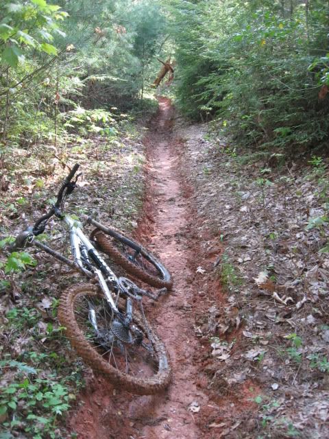
That being said, some sections of it are typically the wettest sections of trails in the area; some mud holes take a long time to dry out. The first section of trail is fast and flowy, but after crossing the road it steepens and tightens up, and has a series of very nice, rideable switchbacks climbing most of the hill. I believe these are the only legitimate set of switchbacks in the Bull Mountain area, although some of the trails could definitely use them.
Here's a video review of one of my favorite rides, combining this trail and the Bull Mountain Loop:

Update 10/21/2010:
The last section of the initial downhill on this trail where it intersects forest road 28-1 was quickly eroding into a deep gully, mostly due to the pretty obvious horse prints in the muddy soil. Yes, the CTHA spent the time and money to put in this new reroute, but if the horses had stayed off the trails when they were wet and if this last section had been better constructed in the first place, it wouldn't have been necessary.
Here is what the new trail end looks like from the road:
While they obviously put some work into this, the construction is absolutely horrible for mountain bikers. The new reroute is too steep, and the gravel they used is very loose and powdery. Not only is the steepness horrible for mountain biking, but I think this will wash out as well in a year or two.
Be careful when approaching this from the top; it looks as if you should continue straight when really you've got to hang a sharp left down the gravel. Here's what it looks like now as you approach the end of the trail:
All things considered, this was a necessary reroute.
Rides at This Trail
http://gregridestrails.blogspot.com/2010/02/riding-for-living.html
http://www.gregridestrails.com/2010/05/week-of-contests-win-some-schwag.html
http://www.gregridestrails.com/2010/07/movie-night-friday-flight-crew-update.html
http://www.gregridestrails.com/2010/07/secret-to-riding-switchbacks-on.html
Your Turn: Do you have more information that needs to be included, or do you have information on new developments since I originally posted this review? If so, please leave a comment and help keep this post up-to-date and as useful as possible.


No comments:
Post a Comment