Turner Creek Trail, Dahlonega, GA
Getting There
From Dahlonega, Georgia head West out of town on Hwy 9. Take a right onto Hwy 52, and then 4.6 miles later take a right onto Nimblewill Church Road at the old Grizzle's Country Store. Pass the Jake Mountain parking lot sign, but take a right at the Bull Mountain sign. Continue right up FS 28-1 (don't take the left towards the Bull Mountain Trailhead) and drive until you reach the fork of FS 77 and FS 28-1. Park somewhere around there. Google Maps interactive trailhead locations
 The Route
Pick up the Bull Mountain Trails map (red) printed by Milestone Press as your crucial navigational resource. Also, the National Geographic Trails Illustrated map #777 is awesome as well, and great for navigating all of the forest roads in the greater Blue Ridge WMA area. The actual length of the singletrack being ridden, if done all the way from the junction with No Tell at the top, is about 2 miles.
There are two main options: Climb straight up FS 77, and either drop in at the half way point near the junction with Jones Creek Ridge (for about a 2, 2.5 mile ride), or continue climbing all the way until you see a forest road (which is the end of No Tell) split off to your right. Turn down that, and then hang a right onto the Turner Creek singletrack for about a 4, 4.5 mile ride.
Or, from the parking spot, go right up FS 28-1, ride past the end of the turner creek trail, all the way up to the beginning of No Tell (223P). Ride No Tell back across and down and hook up with Turner Creek for the final singletrack run. This would be approximately a 5-6 mile ride.
From the bottom of the Turner Creek Trail, turn right on what is FS 28-1, and go up and down a couple of hills (overall climbing) back to your car to complete the loop.
About the Trail
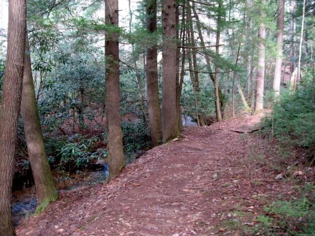
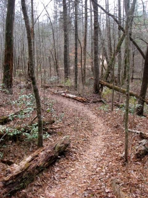
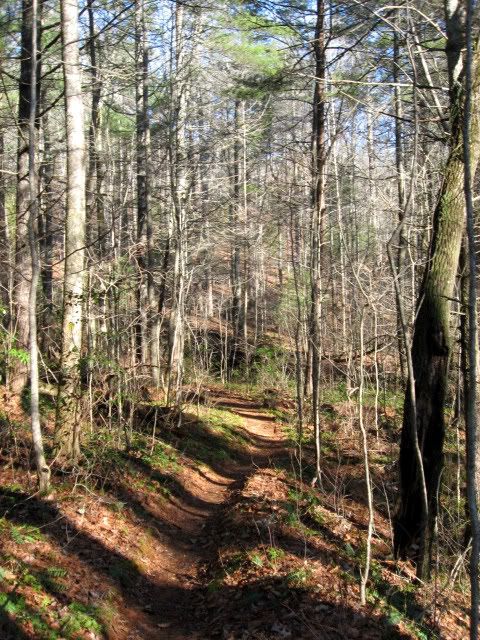
In my honest opinion, this section of singletrack running down from No Tell, and down along Turner Creek is the best-quality singletrack in the entire Bull Mountain and Jake Mountain network. It is definitely some of the narrower trail in the area. The majority of the Bull Mountain network isn't true singletrack at all. Rather, it is a series of old, neglected road grades that has degenerated into singletrack. It doesn't have the beautiful, narrow appeal of genuine singletrack. Turner Creek, however, is a gorgeous piece of trail! It is an excellent downhill, contouring along the side of the ridge with some undulation along it's length, which allows it to drain better than most of the trails in the area, and has kept it from getting worn into a big rut. Ridden the other way as a climb, it isn't too steep to be ridable, and is still enjoyable.
If I can, I try to work Turner Creek into whatever ride I am doing out in the Bull Mountain area.
Video


The Rest of the Trails in the Bull / Jake Mountain Network:
Rides on this trail:
http://gregridestrails.blogspot.com/2010/02/lazy-rider.html
http://gregridestrails.blogspot.com/2010/02/brand-new-brakes.html
http://gregridestrails.blogspot.com/2010/02/pedaling-for-balance.html
http://gregridestrails.blogspot.com/2010/02/sunshine-makes-all-difference.html
http://www.gregridestrails.com/2010/07/movie-night-friday-flight-crew-update.html
http://www.gregridestrails.com/2010/07/friday-flight-crew-update.html
http://www.gregridestrails.com/2010/07/airborne-zeppelin-elite-mountain-bike.html
http://www.gregridestrails.com/2010/06/friday-flight-crew-update.html
http://www.gregridestrails.com/2010/08/piling-on-miles-friday-flight-crew.html
From Dahlonega, Georgia head West out of town on Hwy 9. Take a right onto Hwy 52, and then 4.6 miles later take a right onto Nimblewill Church Road at the old Grizzle's Country Store. Pass the Jake Mountain parking lot sign, but take a right at the Bull Mountain sign. Continue right up FS 28-1 (don't take the left towards the Bull Mountain Trailhead) and drive until you reach the fork of FS 77 and FS 28-1. Park somewhere around there. Google Maps interactive trailhead locations
 The Route
Pick up the Bull Mountain Trails map (red) printed by Milestone Press as your crucial navigational resource. Also, the National Geographic Trails Illustrated map #777 is awesome as well, and great for navigating all of the forest roads in the greater Blue Ridge WMA area. The actual length of the singletrack being ridden, if done all the way from the junction with No Tell at the top, is about 2 miles.
There are two main options: Climb straight up FS 77, and either drop in at the half way point near the junction with Jones Creek Ridge (for about a 2, 2.5 mile ride), or continue climbing all the way until you see a forest road (which is the end of No Tell) split off to your right. Turn down that, and then hang a right onto the Turner Creek singletrack for about a 4, 4.5 mile ride.
Or, from the parking spot, go right up FS 28-1, ride past the end of the turner creek trail, all the way up to the beginning of No Tell (223P). Ride No Tell back across and down and hook up with Turner Creek for the final singletrack run. This would be approximately a 5-6 mile ride.
From the bottom of the Turner Creek Trail, turn right on what is FS 28-1, and go up and down a couple of hills (overall climbing) back to your car to complete the loop.
About the Trail
In my honest opinion, this section of singletrack running down from No Tell, and down along Turner Creek is the best-quality singletrack in the entire Bull Mountain and Jake Mountain network. It is definitely some of the narrower trail in the area. The majority of the Bull Mountain network isn't true singletrack at all. Rather, it is a series of old, neglected road grades that has degenerated into singletrack. It doesn't have the beautiful, narrow appeal of genuine singletrack. Turner Creek, however, is a gorgeous piece of trail! It is an excellent downhill, contouring along the side of the ridge with some undulation along it's length, which allows it to drain better than most of the trails in the area, and has kept it from getting worn into a big rut. Ridden the other way as a climb, it isn't too steep to be ridable, and is still enjoyable.
If I can, I try to work Turner Creek into whatever ride I am doing out in the Bull Mountain area.
Video


The Rest of the Trails in the Bull / Jake Mountain Network:
- Jake Mountain
- Turner Creek Trail
- Jones Creek Ridge Trail
- No Tell Trail
- Jake Mountain parking lot to Bull Mountain parking lot connector trail
- Black Branch, Vietnam, and Black Branch connector Mountain Bike Trails
- Montgomery Creek Trail (Wahsega) (doubletrack)
- The Bee Trail
- High Tower
- Winding Stairs (USFS roads)
Rides on this trail:
http://gregridestrails.blogspot.com/2010/02/lazy-rider.html
http://gregridestrails.blogspot.com/2010/02/brand-new-brakes.html
http://gregridestrails.blogspot.com/2010/02/pedaling-for-balance.html
http://gregridestrails.blogspot.com/2010/02/sunshine-makes-all-difference.html
http://www.gregridestrails.com/2010/07/movie-night-friday-flight-crew-update.html
http://www.gregridestrails.com/2010/07/friday-flight-crew-update.html
http://www.gregridestrails.com/2010/07/airborne-zeppelin-elite-mountain-bike.html
http://www.gregridestrails.com/2010/06/friday-flight-crew-update.html
http://www.gregridestrails.com/2010/08/piling-on-miles-friday-flight-crew.html


0 comments:
Post a Comment