Tsali: Mouse Branch, Bryson City (Almond), North Carolina
 |
| Mouse Branch |
Head West 8 miles from Bryson City, North Carolina on Hwy. 74. Hang a write on NC 28 and go about 3.5 miles past Freeman’s Motel. The turn off onto the Tsali road will be on the right with a sign. Head down that road about a mile and a half, and there will be big signs for the parking lots (on your left).
The Route
From the mountain bike parking lot, head back out the entrance of the lot, down the hill a little ways, and ride around the gate and down the gravel road. Shortly you’ll pass the end of the Thompson loop on your left. After a while, you'll pass a junction with a sign pointing both right and left for Mouse Branch. The "Recommended Path of Travel" sign instructs you to head left and finish climbing up the road like you would if you were riding the Thompson Loop. This is the direction I rode the trail. This direction makes sense, as most of the climbing is conquered on the wider, easier trail and most of the descending comes on the narrower, more technical section.
However, there is an extra loop off of Mouse Branch that's simply called the "Overlook Trail." That trail is one-way, and to work it naturally into the flow of the loop you have to ride opposite of the "recommended" direction of travel. That means that you'd begin the loop by hanging a right onto the trail at the first Mouse Branch sign instead of continuing to the end of the gravel road.
Distance without the overlook is about 7 miles, distance with the overlook is about 9.
Navigational Resources
Timm Muth has written an awesome guidebook with detailed statistics and directions. It includes almost all of the worth-while trails in North Carolina, and features a big section on the Tsali trails. If you're planning on spending a lot of time in NC, this is a great investment! | |
The maps that I have come to live by are all a part of the National Geographic Trails Illustrated series. Easy to read, almost always up to date, tear resistant and water proof, these maps are designed to ride in your Camelback months on end! #784 contains the Tsali Trail System: |
All About the Trail
The Mouse Branch is quite similar to the Thompson Loop, and I assume the other trails at Tsali. However, there are a few key similarities and differences that are worth noting.
Similarities:
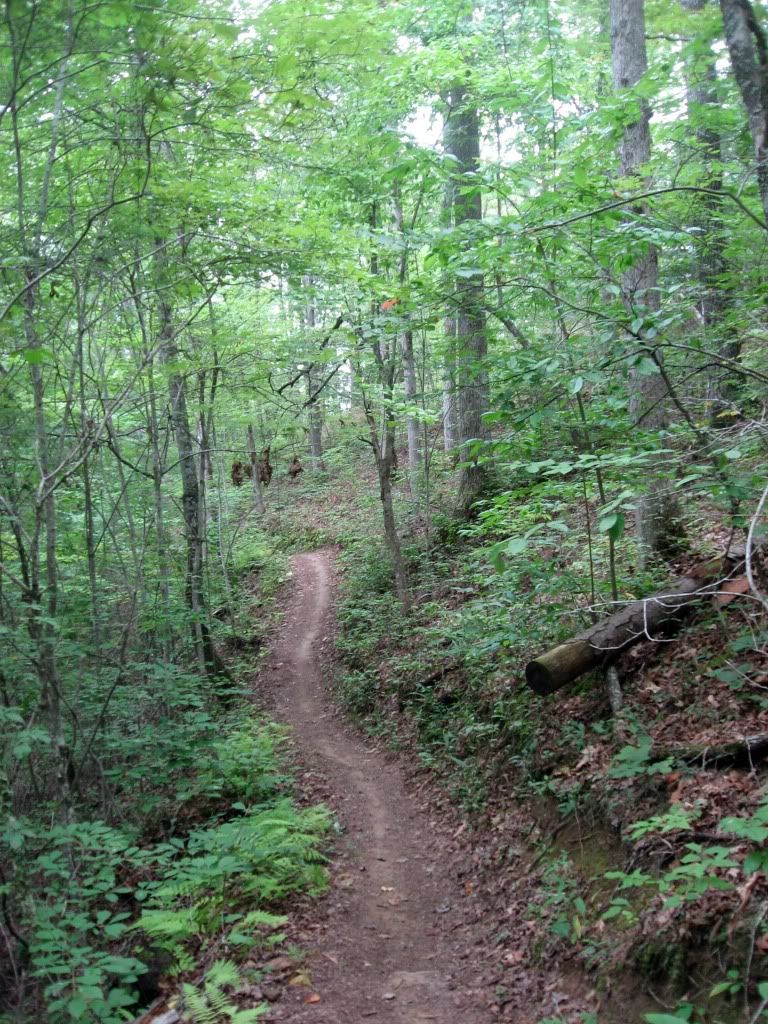
Overall, Mouse Branch contains the same euphoric flow, smooth trails, and quality trail construction of the Thompson Loop. These are the key components that make the Tsali network the famous destination that it is!
Differences:
Sections of the Mouse Branch trail are actually quite a bit more technical than the offering on the Thompson Loop, and if the rumors I hear are true the Right and Left loops are much easier than both of the trails open on Saturday. Still, compared to most everything else in North Carolina and North Georgia, Mouse Branch seems very tame.
One factor that did start challenging me after a while (especially after already doing 8 miles on the TL) were the hills. While easily rideable, the climbs are noticeably steeper than those on the TL, and there was much more alteration between climbs and descents. Instead of a long rolling climb with a fast descent at the end, there was much more up-down-up-down (similar to Stonewall Falls).
 |
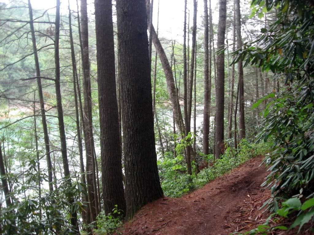
| Trail Above Fontana Lake |
The Mouse Branch trail spends much more time traveling directly above the shores of Lake Fontana. I didn't get to ride it, but from the pictures I've seen of the overlook trail, it offers one of the best views of the lake anywhere!
One final interesting note on the trail: the way that the singletrack was contoured into the hillsides and the ravines was very interesting, and strikingly reminiscent of Stevens Creek. The singletrack wove around the sides of the hills and ravines, and didn't drop down into them. As a result, there was relatively little elevation gain or loss despite the mountainous terrain. This type of trail design insures a well-draining trail (because of the bench cut), and that the climbs won't be too difficult to ride, even in a mountainous area like North Carolina. Your turn: if you've ever ridden a trail with any of these characteristics, let me know about it and what you thought of it in the comments below!
Bottom Line:
Tsali is incredibly famous all across the Southeast, and the Mouse Branch trail only adds to that fame! If you're near Bryson City on a Saturday, ride it!
Additional Information
- There's a $2 per person fee for riding the trails.
- The Mouse Branch trail is open to mountain bikers on Tuesday, Thursday, and Saturday.
- Camping is available in the adjacent Tsali Campground. Primitive sights start at $15 a night, but there are facilities with running water, flush toilets, and hot showers.
Some footage from one of the downhills on Mouse Branch:
Tsali from Greg Heil on Vimeo.
All the Tsali Trails

2 comments:
Greg,
If you hit Mouse Branch the *other* way, it starts with a 1 mile sweet, twitchy, swoopy descent that'll have you cheering before it's done.
Also, check out Tsali's Left Loop next time you're out this way. Some very respectable rock sections (with big bif potential), an excellent view of the lake from the overlook, and a crazy swoopy downhill after. Link Left Loop into the tail end of Right Loop for another long gradual down section, then bail out on the short cut up over the tank traps. Makes for a killer 20 mile loop, and you don't have to pull the heinous uphill sections on County Line Road back. MUCH more challenging than Mouse or Thompson.
Great reviews, bro. thanks for the kudos on the book.
Timm Muth
Hey Timm,
Thanks for stopping by the blog, and for the advice on the Left and Right loop. I'm actually heading up there again this weekend, so your input is timely!
Thanks also for writing the awesome guide book. Its probably one of the most informative I've ever used! I hope to see you around the blog in the future, or maybe we'll cross paths on the trail.
Later,
-Greg
Post a Comment